First Timers Guide to the Pīpīwai Trail & Waimoku Falls
Maui’s Pīpīwai Trail to Waimoku Falls is my favorite stop on the Road to Hana, and my favorite hike on the island!
In just four miles roundtrip journey through an enchanting bamboo forest, pass beneath the sprawling branches of an ancient banyan tree, and get to gaze up at the breathtaking 400-foot Waimoku Falls. And if you’re willing to add on another half mile, you can trek along the Ohe’o Gulch to see dozens of waterfalls pour into the roaring ocean!
In this article I’m sharing everything you need to know before hiking the Pipiwai Trail for the first time, including trail tips, plus some insights into the area’s rich Hawaiian history.
🌺 How the Pipiwai Trail fit into my trip: My Road to Hana Driving Itinerary


About the Pīpīwai Trail & Waimoku Falls
The Pīpīwai Trail winds through Kīpahulu, which was once a thriving taro farming and fishing community of Native Hawaiians. The area is home to hundreds of Hawaiian cultural sites and ruins, including one of Hawaii’s largest heiau (shrine) and is still considered a scared place (wahi pana).
A 1786 journal entry from La Perouse who sailed past Kīpahulu reported how densely populated the area was, with hales (homes) lined 7-10 miles along the coastline. But like the rest of Hawaiʻi, Kīpahulu suffered devastating population loss in the late 1700s and 1800s, when foreign diseases wiped out an estimated 80–90% of Native Hawaiians. By the late 1800s, much of the land here had been converted into sugar plantations.
Today, the Pīpīwai Trail & Waimoku Falls are protected within Haleakalā National Park (yep, that is the same national park you’ll visit if you go to the volcano summit in Maui!)
- 🥾 Length: 3.4-miles roundtrip (optional 0.5-mile add-on to Kūloa Point)
- ⛰️ Elevation gain: 800 feet
- ⏰ Time to hike: 2+ hours
- 🏋🏽 Difficulty: Moderate
- 🎟️ Entry Fee: $30 per vehicle, or free with an America the Beautiful Pass

Additional Resources:
How to Get to the Pīpīwai Trailhead
Located within the Kīpahulu District of Haleakalā National Park, the trailhead is about 10 miles (30 minutes) past Hana town at mile marker 42 of the Hana Highway. For many visitors, Kīpahulu is the final stop on the adventurous Road to Hana.
If you aren’t familiar with it, the Road to Hana is a two-lane country road filled with hairpin turns, seemingly endless roadside waterfalls, and lush-jungle-meets-volcanic landscapes.
Driving the Road to Hana is one of the most popular things to do on the island, but its a packed full-day adventure that will require you to drive at least 6 hours roundtrip.
Finding the Pipiwai Trailhead at Kīpahulu
So, if you want to hike Pīpīwai Trailhead, drive the Road to Hana all the way past Hana town until you reach Kīpahulu.
The park entrance is on the left side of the road and will be obvious. After paying for entry ($30 per vehicle) or showing your park pass and parking, walk toward the Kīpahulu Visitor Center.
From the visitor center, follow the path a few hundred feet until it forks near a traditional Hawaiian hale (house). Take the left fork, cross the road, and your hike begins!

It Takes 2+ Hours… is Hiking the Really Pīpīwai Trailhead Worth it?
Personally, the Pīpīwai trail was my favorite part of the Road to Hana after driving it twice! And its one of my favorite hikes in Hawaii overall, too.
In under 4-miles roundtrip you get to journey through an enchanting bamboo forest, see a giant banyan tree, gaze up at a 400-foot waterfall, and see several smaller waterfalls along the way.
That said, it will take up at least two hours of your limited time on the Road to Hana, and you’ll probably have to cut out some other stops to make room for it. Curious how I did it? Check out my Road to Hana itinerary!


What to Expect & See on the Pīpīwai Trail
Makahiku Overlook
Half a mile into the hike you’ll get a glimpse of 200-foot Makahiku Falls cascading into the gorge below. You don’t get the best view of the falls since a lot of it is blocked by foliage, but don’t worry, even better views are coming!
Banyan Tree
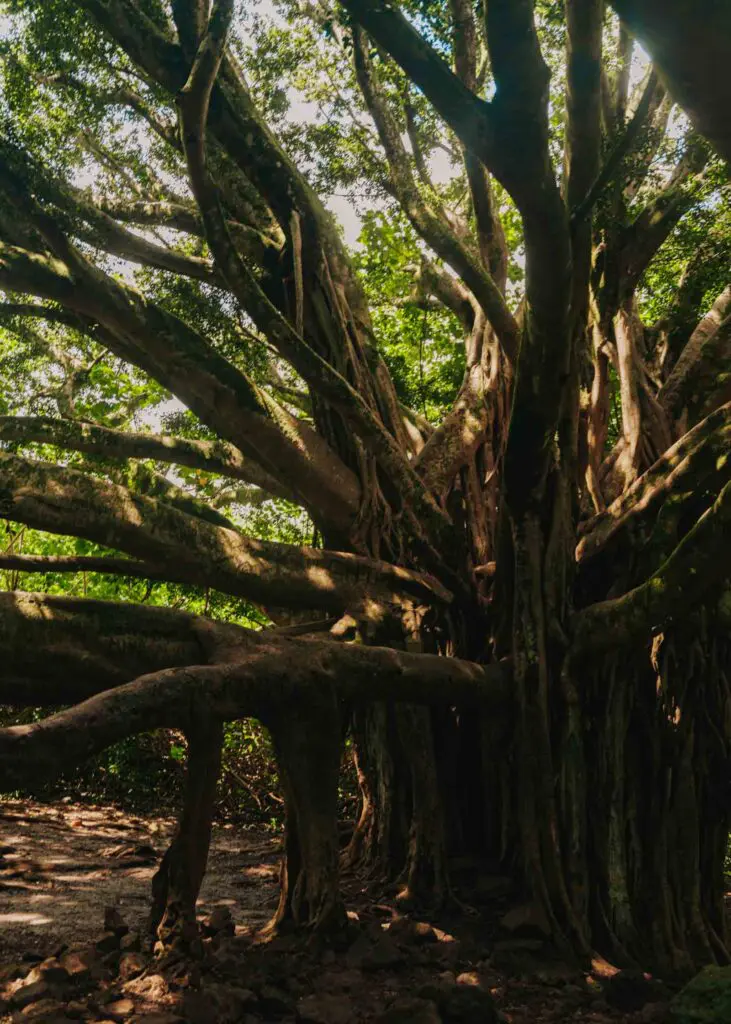
Next, you’ll pass a 100-year-old Banyan tree, it’s one of the oldest banyans on Maui!
Pīpīwai Bamboo Forest
And then we’re onto my favorite part of the trail, the bamboo forest!
After crossing the stream and spotting a few more waterfalls, a wooden boardwalk will lead you through a serene bamboo forest that stretches for around half a mile.
It started raining during this part of the hike, which added to the ambiance, along with the gentle clatter of the bamboo stalks!
Pīpīwai Stream Crossing
Near the end, you’ll need to cross the Pīpīwai Stream. As a fairy active hiker, I found it to be a short and fairly easy crossing, but take care not to slip or submurge your shoes.
Waimoku Falls
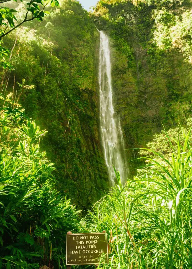
The grand finale of the hike is the 400-foot Waimoku Falls, Maui’s tallest waterfall!
Shortly after the stream crossing you’ll reach a sign that advises against hiking further, though many folks continue to the base of the falls. Thankfully, you still get a up-close view of the falls from this spot if you choose to follow local guidance and not hike to the waterfall base.
ʻOheʻo Gulch (Optional)
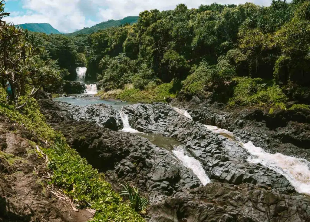
Before or after the hike you can tack on the short 0.5-mile Kūloa Point loop that takes you along the ʻOheʻo Gulch, also called the Seven Sacred Pools.
Since you’ve already driven all the way here, and its only a short walk, I definitely recommend the extra trek to see the cascading pools and waterfalls that tumble into the ocean!
More Hawaii Travel Guides
- The Perfect 5 Day Maui Itinerary: Jungle, Volcano & Beaches
- A First Timers Guide to Visiting ʻĪao Valley in Maui
- How to Spend One Day at Haleakalā, Maui’s Volcano
- The Perfect 1 Day Road to Hana Itinerary (& What to Skip)
- Hawai’i Big Island Travel Guide (For First-Time Visitors)
- 21 Kauai Hidden Gems for Exploring Off the Beaten Path
- 4 Day Oahu Itinerary Full of Sunshine, Aloha, and Adventure
Save for later on Pinterest: